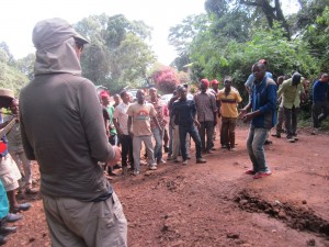
Today was our first of two days in Wilderness, a small town right at the start of South Africa’s garden route, with miles of beautiful beaches and… well, not much else! But that’s what we were here for. We woke up, went upstairs, ad had breakfast, scanning waves for a glimpse of a dolphin or two. Definitely saw a lot of things that might have been dolphins; not a whole lot of things that definitely were dolphins.
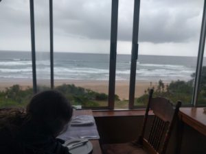
Breakfast.
As you can see from the photo, it was an overcast day, but this was our Beach Day, and we weren’t gonna let that stop us from going to the beach! But since we’d be swimming and leaving our stuff unattended, we didn’t take a camera or anything else with us- just towels and a credit card, pretty much.
That’s really a shame, too, because the beach was absolutely deserted- nobody around to relieve of us our stuffs! We foud a ice place to swim, and then did so. While we were in the waves, a couple came up and set up camp right next to our stuff, which was… odd, because it was literally just us on maybe 5 miles of beach. But so it goes!
Based on a recommendation from our Cape Point tour guide, we climbed up to some now unused railroad tracks and followed them to the site of an abandoned cave restaurant. Well, abandoned isn’t the right word. After a landslide rendered the tracks less-than-train-worthy, the cave restaurant found itself patronless and shut down. A bit later, a Christian mystic fellow named Clifford (!) decided it would make a nice spot for a place of worship, reminiscent of the Throne of the Third Heaven but with driftwood. The mystic wasn’t home, but we still got to glimpse his impressive seashell windchime collection.
Past the church, there was an old rusty bridge crossing a ravine, but we got spooked about crossing it and turned around before reaching the next town (Vic Bay). Of course, we didn’t have a camera, but man! Imagine some cool photos!
We ate lunch at a nice little cafe called Bee Juice and ordered some craft beer with our sandwiches, which we were pretty excited about! We’re not really wine drinkers, and South Africa is a wine country. Remember how South Africans can’t make cocktails? Well, they can’t make beer either. Yikes.
Afterwards, we went to the grocery store and considered (but rejected) going to Off The Rails pub- a converted train station on the old tracks. With supplies in hang from the grocery store, we headed back to showers and a picnic dinner in the sand.
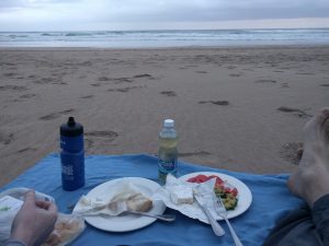
Dinner.
Day 7: Desert and Caves and Big Bird and Wilderness!
Wednesday , 18, January 2017 South Africa 2017, travel Leave a commentAnother big day!
We woke up in our cabin in the Karoo and set out on a little hike around the farm. The temps were supposed to be in the high 100s (but luckily a dry scorchingly unbearable heat.), so we got up early to try to avoid that. But of course, we didn’t and it was super hot! We saw some great lizards, got a nice view of the farm, and got to spend a few minutes with the owner, her two probably Australian shepherds, and oen ridiculously goofy, gigantic Great Dane puppy.

The little black lizards are pretty exciting the first time you see them.
We packed up and left pretty early, cause we had a ton of driving to do. Our first stop was in Calitzdorp- the heart of the South African Port-style fortified wine country. It was a little early for port, alas, but we did pick up a little purple hippo to add to our ceramic hippo collection (yeah.), and had a tremendously good scone at Eberhart’s pipe shop (where they do sell pipes!) We almost missed our next appointment because they apparently had to make the cream from scratch (including raising cows to maturity, the milking them and whipping the resulting cream). but it was worth it! That scone was tremendous! Tremendous! I mean, it wasn’t big or anything, but we were both quite tremended.
Post Calitzdorp, we rushed over to the Cango Caves, where Brett was too much of a wimp (claustrophobic he claims, like giving something a Greek name makes you something other than a wimp) to take the “Adventure Tour” which involved some real tight passages, but we still went on the regular tour, which was still pretty impressive! The closest-to-the-surface areas of the caves hve been occupied for tens of thousands of years (!!!), but the internal areas weren’t discovered until much more recently, like the 19th century. Pretty impressive!
The first big room had really great acoustics and was until recently the home for various musical performances. Our guide used the opportunity to sing some gospel songs- ostensibly to show off the quality of the auditorium, but felt more like just showing off his own pipes.
Post-caves, we went to the first ostrich farm we could find, cause this is ostrich country! It felt like it might be a little cheesy, but OMG IT WAS AWESOME!! Our guide had an amazing accent, especially when saying the word “ostrich”- which she said a lot! IT was great! Brett kissed an ostrich, basically, thanks to the guide convincing him to hold a food pellet between his lips.
The sickness we’d contracted in Cape Town (or on the plane, more likely) had jumped from one of us to the other, so we stopped in the booming metropolis of Outdshorn for lunch and pills. The pharmacists there are all fantastic- asking you about your symptoms, etc, before suggesting the right drug. There was also a broken automatic door at the pharmacy, which we dumbly stood in front of for 30 seconds until someone pointed out the “BROKEN, PLEASE PULL” sign.
Driving south to the coast, the landscape quickly changed from dry, red desert to lush mountains and then back to a Central California-looking cliffy coastline. We found our hotel- the Pink Lodge- and walked out onto the water. A gigantic (like.. 3 feet across? Or should I say 1 meter…) jellyfish greeted us on the shore, along with hundreds of tiny snails, which, to our surprise/chagrin/disgust/etc apparently eat beached jellies! Hooray! We ate at the strongly recommended Salinas, which… idk, let’s just say if it was named after Salinas, Kansas, I wouldn’t have found that shocking. But we saved the cork from our champagne, so we’re likely to remember that mediocre meal for ages.
Day 6: The Driving Begins- Cape Town to the Klein Karoo
Tuesday , 17, January 2017 South Africa 2017, travel Leave a commentOkay! Our time in the booming metropolis is ending, and our time driving begins! We’ve got a long day today, so we get up early and call an Uber to take us to the Avis location. Unfortunately, the Uber driver gets a flat immediately outside our apartment, so we had to get another car.
The line at the Avis dealership was a little long, but that was nice, because Brett needed some time to get amped up about driving on the left. We ended up with a Ford Ecosport, which was great! Because we were burning liters and driving meters, we have no idea how eco the car really was, but we were happy to have it. Crucially, it came with a USB charger! No more worries about phones dying in the middle of the desert.

This is wikipedia photo of an Ecosport! Thanks, Wikipedia!
We headed out of Capetown toward the Northeast. Our car came equipped with an EZ-pass type thing for the toll roads, but we discovered that it didn’t actually work as we entered our first toll tunnel. But that wasn’t a big deal, cause there was a toll booth operator, so we could pay in cash. But we didn’t have cash, which wasn’t a big deal because they took credit cards. But they only took South African-issued credit cards (?!?!), which finally wasn’t a big deal when the South African patiently waiting behind us exited his car and walked up to pay the toll for us! Whoops.
The tunnel was frightening! In Brett’s zeal to not drive in the right lane, he tended to drive partially in the left shoulder. Which is fine when there’s a shoulder, but less fine when it’s a curb and you’re in a tunnel and there’s a giant 18-wheeler on the other side! Whew! But the tunnel eventually ended and everyone agreed Becca should feel comfortable warning Brett when he was sliding leftwards.
Driving was mostly fine, actually. It was super weird, but South African drivers are fanstastic! We’d been warned otherwise, but it was really smooth! People pulled over to le tyou pass them, and when they wanted to pass you, they’d get close without tailgating too hard, then flash their blinkers in gratitude after they passed! So nice!
Our first stop was in Montagu, a nice little town with an ibis garden (?) and a church and some shops and people that spoke to us in Afrikaans Which we didn’t know what to make of, feeling so foreign, but so it goes. There was also a Hadassah resale shop that seemed to specialize in wine carriers.

I really thought you could see more ibises in this photo.
After a little wandering, we kept on to Barrydale, where we had lunch at a weird little restaurant (previously identified in our thorough itinerary!) called Diesel and Creme. Food was delicious, though we didn’t spring for the milkshakes, despite looking really super delicious. Also did some grocery shopping and attempted to visit a local artists’ studios gallery, but it closed early that day. Bummed.

From Barrydale, made our way to the Place, a little cabin on a farm (way) outside of Ladysmith (NB: the Ladysmith in the Western Cape is Ladysmith. Ladismith is in KZN.) The cabin smelled delicious- we’ve been meaning to follow up with the owner to see what her homemade atomizer fuel was. We spent the afternoon walking around the dry riverbed running through the property, following animals tracks and listening to the wind through the reeds.
Also, there were a lot of dead crabs, which went sadly unphotographed. We cooked dinner (curried potatoes!) and ate outside, then spent hours staring at some of the most amazing stars we’d ever seen. The kind of night that makes you realize why they call it the Milky Way. We thought the hood of our car would make a great place to search for shooting stars and ogle Venus, and it would have been, had Brett not dented the car. Thankfully, it went unnoticed by Avis. Whoops!
Day 5: Capetown, Cape Point, Cape Good Hope
Monday , 16, January 2017 South Africa 2017, travel Leave a commentAfter spending a few days in Cape Town, we ventured out of the city with a tour company to check out Cape Point, which our guide was careful to point out was the most southwesterly point of Africa; Cape Algulhas is actually the southern most point. We wouldn’t be making it there, despite someone’s fascination with arbitrary superlatives.
Our tour group was maybe 12 people, mainly European, to the extent that describes Brits… The tour started in the old Cape Malay community, Bokaap, known for brightly painted houses, in which regard it didn’t disappoint:

See? It could be a Tide commercial in a world where we laundered our homes.
The tour guide told us a story about why the houses were painted such bright colors (and, like Boston, it wasn’t to help drunks identify their house). In what was supposed to be a shocking reveal, but just seemed… obvious, it turns out people painted their houses bright colors because they both could and wanted to.
After this, we drove out and around Table Mountain and made our way to Boulder Beach on the Cape Peninsula, best known for its Cape Penguin colony. Despite the wind whipping around sand at lacerating rates, we spent a ton of time ogling waterfowl (can we call them that?) and quietly wondering why so much time had been allotted to… penguins. Which is a weird thing to say for an animal-obsessive, but seriously, penguins don’t do much. Except these two lovebirds:

*dorbz
We followed this up by getting back in the car and driving further south to the actual Cape Point, where we piled out of the car to clamber up the very top of the Cape of Good Hope. Which was pretty nice! Unlike with the penguins, unfortunately, we weren’t allotted a ton of time, so we had to kinda rush up and down. The photo-op friendly Cape of Good Hope sign was the scene of a great number of people friendlyly fighting for time by themselves. ( One thing that gives me joy is seeing huge groups of people all taking the same photo; I loved this.- brs)

After this, we made our way back to the city, stopping at a beautiful vineyard to get some great wine, though our tour company was def getting a major kickback from the vineyard in exchange for customers. But that’s okay! On the way home, we had a little adventure when a big open-top sightseeing bus was doing some DIY tree-trimmming and caused a giant branch to come crashing down on our van. Pretty intense!
The tour was pretty good, but it was a lot of driving. The tour company prided itself on being young and hip, which was… maybe not so great. There was a kind of post-whatever blase attitude about tours. They weren’t gonna bore us with all the details of everything we were seeing, just taking us to the places we wanted to go! But, you know, it’s a tour, so maybe a little bit more memorized patter would have been a good thing.
Our driver dropped us at the Company’s Garden, which was right by our apartment. IT’s also the location of a big museum (which I forget) but it was closed, and the old synagogue, also closed. But the garden was nice, especially the cats and squirrels. We stopped in an open cathedral on the way home and sneakily watched choir practice!
Dinner was the Planet Restaurant, located in a hotel run by the same people who ran the hotel featured during our aperitif honeymoon last June. And it was delicious, again! No photos there, alas, but it did have a gorgeous starry chandelier.


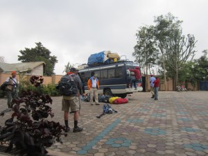 Loading the truck.[/caption]
From the tour itinerary:
Day 1: MACHAME GATE to MACHAME CAMP 9,400’ ~2865m ? 6.8 mi ? 5-7 hrs After a restful night and an enjoyable breakfast at the hotel, you will be met by your Climb Kili guide and other mountain crew where we will transfer you from the hotel to the Machame Gate. We now leave the park gate and walk through the rain forest on a winding trail up a ridge. Lower down, the trail can be muddy and slippery. Gaiters and trekking poles are a good idea here. At Machame Camp your tent will be set up and personal belongings will be ready for you as well as dinner.So! It's finally here. Wake up, breakfast, struggle and mostly fail to remember names from the night before. Then we pile into a big Landcruiser looking thing and head off. After a couple hours we're there, at Machame gate, where the adventure begins. Well, where a lot of standing and waiting begins. And we all signed in at a little window, which was kinda fun, though required everyone to rummage around their packs to find their passport numbers, which are seemingly impossible to memorize. Then we eat a lunch of peanut butter and jelly sandwiches. Somehow, 17 grown men split a single jar of peanut butter. They weren't large sandwiches. [caption id="attachment_9470" align="aligncenter" width="225"]
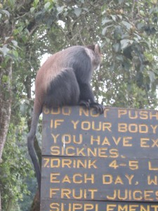 No pushing.[/caption]
After lunch, we meet all the other guides.And then we start to walk! At this point, we're in a pretty jungly area. The trail is really wide, and everybody is pretty excited, but we're going slow. The refrain we're always told and tell each other is pole pole- "slow, slow." We're not to tire ourselves out. We go slowly. It's for the best. I agree.
So we walk and walk and then we come to a clearing and we get our first glimpse of the mountain we're supposedly climbing. It looks impossibly far away, and my budget camera can barely even register it, but it's there. And we're excited and we take a ton of pictures. A few minutes walking later we're at our camp for the night, where we're greeted by our porters. There's approximately 3 porters/dude, but one dude in particular will always be carrying your stuff ahead of you every day.
[caption id="attachment_9479" align="aligncenter" width="300"]
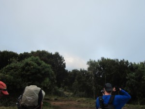 First view of the mountain. You can just barely see it.[/caption]
Mine's name was Veus. He was great- not just cause he carried my stuff for me, which is obviously great, but he always found me when I showed up at the camp at the end of the day's hike and enthusiastically showed me to the tent where he'd put my stuff. He was about 5'6" and 120 pounds, maybe 20? And every day he would carry my stuff for me, leaving me with just a small backpack filled with water and rain gear.
We ate dinner in our mess tent, which is a big orange and white dome thing that you'll see a lot of in these photos. Then we went to bed, where I discovered my sleeping bag wasn't quite up to the task. Whoops.
[gallery ids="9483,9478,9462,9464,9465,9466,9467,9468,9469,9470,9471,9472,9473,9474,9475,9476,9477,9479,9480,9481,9482"] " data-title="Climbamanjaro 2015, Day 3- I Gotta Be a Machame" data-big="" />
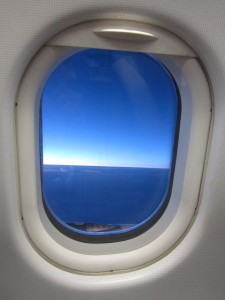 Tanzania, in particular. Which I always kinda wanted to rhyme with Tasmania, but it doesn't. Unless you are the Dutch pilot I had today, who pronounced it the typical way when he was speaking Dutch. But when he spoke English, it did rhyme with the land of canis-looking marsupial. But what? I'm in Africa.
Also in the southern hemisphere, but I've been here before, here understood broadly.
[gallery ids="9372,9373,9374,9375"]
I had a pleasant flight to Amsterdam, where I met my dad and our (well, his, I suppose, but Tom's cool, so our) Tom. We had coffee and, after 12 minutes (according to Tom) began talking about politics. The flight to Kilimanjaro airport was fine, border control was fine. The ride from the airport was super dark and a little frightening, thanks to Gideon the thrill seeking driver. Food was delicious. Hotel wasn't what nor where we expected, and the hot water blasted out through a broken valve rather than the shower head, but it had beds, so it was wonderful.
We're the first to arrive. Two other fellas were supposed to arrive with us, or near us, or something, but they didn't show up. Rest of the group will show up tomorrow. " data-title="Thrillamanjaro 2015, Day 0: I'm in Africa!" data-big="" />
 Arusha city.[/caption]
First time waking up in Africa proved to be uneventful, just like we like it. Breakfast at the hotel was delicious. The staff said "You're welcome" frequently- the way we might say "Bon Apetit" or "here you go" or whatever- not just as a response to "Thank You." Which was honestly kinda jarring at first, cause it felt like they were always preempting our thanking them, or subtly reminding us that we should be thanking them or something. Eventually we figured out that it was just what they said, but even at the end of the trip, unexpected "you're welcomes" still caught me off guard.
Yes, you come to the blog to hear what I think about you're welcome. Point is, breakfast was good.
We didn't know how tired we'd be, so we wanted time to acclimate or something, but basically we didn't have anything to do this day, but all the energy that comes with being in a new place for the first time. Our contact in Tanzania offered to make arrangements for us to explore the city of Arusha and the cultural center/art museum/cash-extraction-center a little bit, which we did. We saw the market, ate at an American-friendly restaurant filled with wifi-addicted tourists, and spend a looooot of time t-shirt shopping. (I got one with the pretty handsome Tanzanian flag on it, because i like t-shirts that announce my vacations.)
[caption id="attachment_9378" align="aligncenter" width="300"]
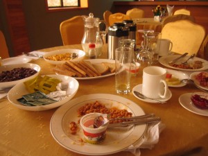 Beans, yogurt. Even a Spanish omlet (not pictures.)[/caption]
There was still no sign of anyone from our group. And no internet at the hotel, so we're just kinda hanging out, wondering where everyone is. But there's food at hot water, and that's really all I ask. Ever.
[gallery ids="9378,9379,9380,9382,9383,9384,9385,9386,9387,9388,9389,9390,9391,9800,9801"] " data-title="Citymanjaro 2015, Day 1: Arusha Blood to the Head" data-big="" />
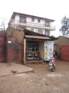 Mechanics.[/caption]
Today the plan is to go see the Meru village and some waterfall. As it turns out, we linger too long at the Meru village and we don't get to see the waterfall, though we're suspicious about whether the waterfall was really ever part of the plan. Kind of a bait-and-switch from the touring outfit we signed up with. Turns out the bait-and-switch is their signature move. BUT I'm not here to complain.
The Meru village didn't seem like a village village, but it's kind of hard to say what we were really seeing, other than a tourist attraction showcasing their lifestyle. It's kind of an odd experience, I think, but a pleasant one and one I'm glad to have had. We sat down for some delish tea, then they took us on a tour of their biofuel plant. Which was two cows in a stall, eating banana tree bits (I think) and sweeping their by-product into a tank where the methane was siphoned off and sent directly into the kitchen. Way cheaper than piping natural gas everywhere way cooler than just buying a propane tank or whatever. Plus cows are cute.
[caption id="attachment_9404" align="aligncenter" width="300"]
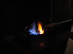 When the flame is yellow, you need to clean the filter.[/caption]
We also got to walk through a coffee plantation, but not a massive one like I imagined sprawling for miles and miles, but like a little coffee grove, growing under banana trees- just one family's plot. Apparently everyone's got coffee plants they take care of and harvest and sell to a co-op. The men in the family are responsible for the coffee, the women for the bananas. Seems fine to me, as I love coffee and am ambivalent about bananas.
After walking around a bit and see other stuff they do at the village, like make furniture and dig for rocks mine minerals. (Dumb realization of the moment: mine and mineral are probably etymologically related.) Then we got to make coffee! We didn't dry the berries, cause that takes time, but we husked them and sifted them and roasted them and ground them and (finally) drank them. Alas, it wasn't good, but I suspect it's cause they put a bunch of amateurs in charge of the roasting. The coffee I ultimately bought from them was pretty tasty when I made it at home.
Post Meru village, we drove to another market but decided to just take photos from the van, as saying "No thank you" over and over is tiring and makes you feel bad, I guess. So we went back to the hotel, where the rest of our posse had arrived. They basically had every flight issue you could have, and got rerouted through Nairobi, lost a ton of luggage, etc, but they were there and the luggage would get to teh hotel in time for our departure the next day. That night we had a planning meeting met our head guide (Raymond), ate a crazy overpriced dinner (even by American standards), and repacked our bags for the final time.
[gallery ids="9393,9394,9395,9396,9397,9398,9399,9400,9401,9402,9403,9404,9405,9406,9407,9408,9409,9410,9411,9412,9413,9414,9415,9416,9417,9418,9419,9420,9421,9422,9423,9424,9425,9426,9427,9428,9429,9430,9431,9432,9433,9434,9435,9436,9437,9438,9439,9440,9441,9442,9443,9444,9445,9446,9447,9448,9449,9450,9451,9452,9453,9804,9803,9805,9806,9454,9455,9456,9457,9458,9459,9460"] " data-title="Touramanjaro 2015, Day 2: Meru Me!!" data-big="" />
When the flame is yellow, you need to clean the filter.[/caption]
We also got to walk through a coffee plantation, but not a massive one like I imagined sprawling for miles and miles, but like a little coffee grove, growing under banana trees- just one family's plot. Apparently everyone's got coffee plants they take care of and harvest and sell to a co-op. The men in the family are responsible for the coffee, the women for the bananas. Seems fine to me, as I love coffee and am ambivalent about bananas.
After walking around a bit and see other stuff they do at the village, like make furniture and dig for rocks mine minerals. (Dumb realization of the moment: mine and mineral are probably etymologically related.) Then we got to make coffee! We didn't dry the berries, cause that takes time, but we husked them and sifted them and roasted them and ground them and (finally) drank them. Alas, it wasn't good, but I suspect it's cause they put a bunch of amateurs in charge of the roasting. The coffee I ultimately bought from them was pretty tasty when I made it at home.
Post Meru village, we drove to another market but decided to just take photos from the van, as saying "No thank you" over and over is tiring and makes you feel bad, I guess. So we went back to the hotel, where the rest of our posse had arrived. They basically had every flight issue you could have, and got rerouted through Nairobi, lost a ton of luggage, etc, but they were there and the luggage would get to teh hotel in time for our departure the next day. That night we had a planning meeting met our head guide (Raymond), ate a crazy overpriced dinner (even by American standards), and repacked our bags for the final time.
[gallery ids="9393,9394,9395,9396,9397,9398,9399,9400,9401,9402,9403,9404,9405,9406,9407,9408,9409,9410,9411,9412,9413,9414,9415,9416,9417,9418,9419,9420,9421,9422,9423,9424,9425,9426,9427,9428,9429,9430,9431,9432,9433,9434,9435,9436,9437,9438,9439,9440,9441,9442,9443,9444,9445,9446,9447,9448,9449,9450,9451,9452,9453,9804,9803,9805,9806,9454,9455,9456,9457,9458,9459,9460"] " data-title="Touramanjaro 2015, Day 2: Meru Me!!" data-big="" />Day 3: SHIRA CAMP to BARRANCO CAMP 13,000’ ~ 3962m ? 5.6 mi~10 km? 6-8 hrs Today you depart Shira Camp in the morning taking the path which rises up gradually towards the Kibo peak, as we continue, our direction changes to the southeast towards the Lava Tower, also known as the "Shark's Tooth." Shortly after the tower we continue down to the Barranco Camp at an altitude of 13,000ft~ 3962m. Dinner and overnight stay at Barranco Camp.Today we walked some more. Kind of a long day, but great. I don't have any specific memories, really. The lava tower (where we lunched) was great. I spent some time climbing on it and took a toooon of photos of a little mouse/chipmunk looking thing that I found. I only published one, because obviously, but it was pretty fun. He was actually there with a buddy, but I was never able to get a photo of both of them together. The Lava Tower itself was cool. I mean, it was just as it sounds- a big tower of lava. Would have been cool to have been there when it was formed. But then I wouldn't have internet access, I reckon. [caption id="attachment_9547" align="aligncenter" width="225"]
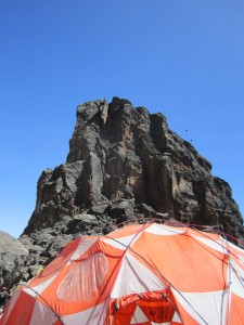 Lava tower, dining tent.[/caption]
At one point, I found a broken floor tile. That was pretty cool. And we walked by a face of the mountain- I think the Western face, or Western something, that you can also use for summiting, but it's a technical climb that requires ropes and stuff. But it's fun fantasizing that maybe I could do it. Anyhoo, here are some pictures.
[gallery ids="9524,9525,9526,9527,9528,9529,9530,9531,9532,9533,9534,9535,9536,9537,9538,9539,9540,9541,9542,9543,9544,9545,9546,9547,9548,9549,9550,9551,9552,9553,9554,9555,9556,9557,9558"] " data-title="Kilimousejaro 2015, Day 5- Don't go Barranco My Heart (i couldn't if I tried)" data-big="" />
Lava tower, dining tent.[/caption]
At one point, I found a broken floor tile. That was pretty cool. And we walked by a face of the mountain- I think the Western face, or Western something, that you can also use for summiting, but it's a technical climb that requires ropes and stuff. But it's fun fantasizing that maybe I could do it. Anyhoo, here are some pictures.
[gallery ids="9524,9525,9526,9527,9528,9529,9530,9531,9532,9533,9534,9535,9536,9537,9538,9539,9540,9541,9542,9543,9544,9545,9546,9547,9548,9549,9550,9551,9552,9553,9554,9555,9556,9557,9558"] " data-title="Kilimousejaro 2015, Day 5- Don't go Barranco My Heart (i couldn't if I tried)" data-big="" />Day 4: BARRANCO to KARANGA CAMP 13100’ ~ 3992m ? 2.2 mi~3.2 km ? 4-5 hrs Today the group conquers the great Barranco Valley and up the Barranco wall, andYou guys, I cannot get over how much I love having coffee delivered to me when I wake up. It's so great.adventuourse [sick!!!] stretch that ushers us into the arctic zone of Kili. We continue the trek on the South Circuit path through the Karanga Valley. We camp tonight at Karanga Camp.
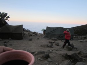 Like the description says, today we conquer Barranco wall. Which is, you know, really pretty much just a wall. This was the most fun hiking of the trip, I thought. Lot's of climbing, carefully picking out handholds, etc. Okay that makes it sound like it was some technical thing, but it wasn't just walking. Really fun. Kinda slow going, and seems like everyone hiking that day left at the same time, so it was a bit trafficky, but it was really pretty fun. As you're going up, you keep thinking you've reached teh top, only to get there and see it goes up. Then that feeling repeats, maybe four times. But fun fun fun.
Oh, i forgot. Before we get to the wall, we have to go through a little valley and cross a little river. Which, for the sake of the title of this post, we'll call the Barranco river, though really it was barely a creek.
After we climbed the wall, we walked down, down, down. I think this was one of those days where we went up like 2,000 feet in the morning and then spent the rest of the day going down. Went through long, rocky valley one after another it seemed. At this point, there's really little vegetation- little shrubby things but kinda dispersed, and nothing you couldn't see over. Feels like Iceland, actually.
[caption id="attachment_9615" align="aligncenter" width="225"]
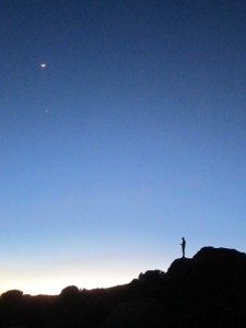 Texting man, the moon, Venus.[/caption]
Since the next couple days involve a lot of altitude, we get schooled on the portable hyperbaric chamber that they bring along. It looks cool, but I reckon it would be pretty boring to actually have to use. I wasn't totally paying attention though, cause the meeting they called to discuss the chamber was right in the middle of a really gorgeous sunset, which I took about a thousand pictures of.. Thankfully, my lack of paid attention didn't cause any problems- our guide continued his 10+year career without having a need for it.
[gallery ids="9560,9561,9562,9563,9564,9565,9566,9567,9568,9569,9570,9571,9572,9573,9574,9575,9576,9577,9578,9579,9580,9581,9582,9583,9584,9585,9586,9587,9588,9589,9590,9591,9592,9593,9594,9595,9596,9597,9598,9599,9600,9601,9602,9603,9604,9605,9606,9607,9608,9609,9610,9611,9612,9613,9614,9615,9616"] " data-title="Kilidudejaro 2015, Day 6: Whites Ford Barranco" data-big="" />
Texting man, the moon, Venus.[/caption]
Since the next couple days involve a lot of altitude, we get schooled on the portable hyperbaric chamber that they bring along. It looks cool, but I reckon it would be pretty boring to actually have to use. I wasn't totally paying attention though, cause the meeting they called to discuss the chamber was right in the middle of a really gorgeous sunset, which I took about a thousand pictures of.. Thankfully, my lack of paid attention didn't cause any problems- our guide continued his 10+year career without having a need for it.
[gallery ids="9560,9561,9562,9563,9564,9565,9566,9567,9568,9569,9570,9571,9572,9573,9574,9575,9576,9577,9578,9579,9580,9581,9582,9583,9584,9585,9586,9587,9588,9589,9590,9591,9592,9593,9594,9595,9596,9597,9598,9599,9600,9601,9602,9603,9604,9605,9606,9607,9608,9609,9610,9611,9612,9613,9614,9615,9616"] " data-title="Kilidudejaro 2015, Day 6: Whites Ford Barranco" data-big="" />Day 5: KARANGA CAMP to BARAFU CAMP 15,300’ ~ 4663m ? 2.2 mi~3.5 km ? 4-5 hrs Today we take a slow pace to Barafu Camp from Barafu you will have excellent views of Kibo and Mawenzi peaks. Barufu Camp is situated on an exposed ridge, so it is necessary to familiarize yourself with the terrain before dark. We continue to acclimatize, rest, relax and make necessary preparation for the summit day ahead.Tofday is the day before we summit! Which means when we go to bed tonight, we'll getting up just a few hours later so we can make the ascent in time for sunrise at the top. So today is a relatively easy day, really. It's also a really rocky day. Going through my photos, there are tons of photos just of rocks. And more rocks. And then the sky and clouds and stuff, but then also of rocks. That's accurate though- I definitely remember the rocks. Seems like valley after valley we walked through, each one... rocky. I've got nothing to say. [caption id="attachment_9638" align="aligncenter" width="300"]
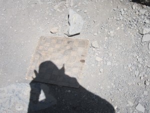 Handmade checkerboard.[/caption]
Eventually we get to Barafu camp, where we sign in. We elect to go stay at a camp another hour up the mountain in order to make the next day as easy as possible. Because it's not going to be easy. At all. But today is. Even with the extra hike to the further camp, we get in in time for lunch. So we eat it. Then we lounge around- it's a warm day, thankfully- and get psyched for that night.
Eventually night comes and with it dinner. The original plan was for us to be woken up around midnight or 1 to start our night time hike. Unfortunately, our guide decided that that wasn't a great idea. Basically, over the previous days we had proven to be a really fantastic, fun, affable, charming, attractive, patriotic, magnanimous, elegant, beatific, and regal group. BUT we had not proven to be a fast group. Nor a quick group. Nor a speedy group. In fact, along with all the great things that our group *was*, we were also a SLOOOOOOOOOW group. That's fine- pole pole after all- but apparently we took it a little too seriously.
The point is that our guide thought that even if we left at midnight, and even with the hour we saved by hiking to the Barafu high camp rather than staying low, we still didn't have much of a chance of making it to the summit for sunrise. As a result, he thought it would be best for us to leave around 4 (still plenty early), but that way we'd get extra sleep and would spend less time walking in the cold cold, dark dark.
It was a little disappointing, frankly, but the guide was surely right, and it would have been pretty annoying to wake up that early and hike that coldly and darkly and then have sunrise happen when we were in the worst part of the slog to the summit. So, you know, no big deal. We go to bed around 9 or so and dream, briefly. Tomorrow we'll be on the roof of Africa, and that will be amazing, regardless of the relative position of the sun.
[gallery ids="9618,9619,9620,9621,9622,9623,9624,9625,9626,9627,9628,9629,9630,9631,9632,9633,9634,9635,9636,9637,9638,9639,9640,9641,9642,9643,9644,9645,9646,9647,9648,9649,9650,9651,9652"] " data-title="Kilobytejaro 2015, Day 7: Barafubama" data-big="" />
Handmade checkerboard.[/caption]
Eventually we get to Barafu camp, where we sign in. We elect to go stay at a camp another hour up the mountain in order to make the next day as easy as possible. Because it's not going to be easy. At all. But today is. Even with the extra hike to the further camp, we get in in time for lunch. So we eat it. Then we lounge around- it's a warm day, thankfully- and get psyched for that night.
Eventually night comes and with it dinner. The original plan was for us to be woken up around midnight or 1 to start our night time hike. Unfortunately, our guide decided that that wasn't a great idea. Basically, over the previous days we had proven to be a really fantastic, fun, affable, charming, attractive, patriotic, magnanimous, elegant, beatific, and regal group. BUT we had not proven to be a fast group. Nor a quick group. Nor a speedy group. In fact, along with all the great things that our group *was*, we were also a SLOOOOOOOOOW group. That's fine- pole pole after all- but apparently we took it a little too seriously.
The point is that our guide thought that even if we left at midnight, and even with the hour we saved by hiking to the Barafu high camp rather than staying low, we still didn't have much of a chance of making it to the summit for sunrise. As a result, he thought it would be best for us to leave around 4 (still plenty early), but that way we'd get extra sleep and would spend less time walking in the cold cold, dark dark.
It was a little disappointing, frankly, but the guide was surely right, and it would have been pretty annoying to wake up that early and hike that coldly and darkly and then have sunrise happen when we were in the worst part of the slog to the summit. So, you know, no big deal. We go to bed around 9 or so and dream, briefly. Tomorrow we'll be on the roof of Africa, and that will be amazing, regardless of the relative position of the sun.
[gallery ids="9618,9619,9620,9621,9622,9623,9624,9625,9626,9627,9628,9629,9630,9631,9632,9633,9634,9635,9636,9637,9638,9639,9640,9641,9642,9643,9644,9645,9646,9647,9648,9649,9650,9651,9652"] " data-title="Kilobytejaro 2015, Day 7: Barafubama" data-big="" />Day 6: BARAFU to SUMMIT to MWEKA CAMP 19,340’~5,895m ? 13 mi~21 km (5 km ascent/ 12 km descent) ? 7-8 hrs ascent~4-6 hrs descent Tonight is the night! A midnight start to conquer the highest point in Africa. This section of the route is considered one of the steepest on the non-technical paths of Kilimanjaro. It is a 6-7 hour hike to Stella Point in order to see the sunrise. We continue our way to the summit between the Rebmann and Ratzel glaciers. We head in a northwesterly direction and ascend through heavy scree towards Stella Point on the crater rim. This can be the most mentally and physically challenging portion of the trek. From Stella Point you can see the summit; just 1 hour to Uhuru Peak and the rooftop of Africa! We then descend down to Mweka Camp for dinner and celebration.Like I said yesterday, we had a change of plans. Rather than leaving super early and getting to the summit at sunrise, we just left a little early. So. Around 3:30 we were woken up with the customary coffee/tea, then we pretty much immediately left. I went to bed fully clothed (I think everyone did), so it was a pretty quick up-and-at-em. [caption id="attachment_9668" align="aligncenter" width="300"]
 My camera can't focus, but nbd.[/caption]
So in the dark we start walking. And in the cold we start walking. It was really fun- walking in the dark. I tried to take as much time as possible to just look up- the stars were amazing and so much of the previous nights I was too cold to just sit outside at night for too long. Alas, we were walking in the dark, so I had to spend a fair amount of time watching the ground.
So. Walking in the dark. There's not a lot to say about it. After a couple hours I was getting reeeeal cold. Well, not I was actually fine, broadly speaking, but my toes were getting cold cold cold! So I popped out a couple of those chemical handwarmers and jammed them into my boots. They take awhile to get started, but after an hour or so, feeling was back in Toesville. So that was pretty cool!
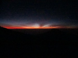
Eventually the sun rose.
[caption id="attachment_9669" align="aligncenter" width="300"]
 Sunrise.[/caption]
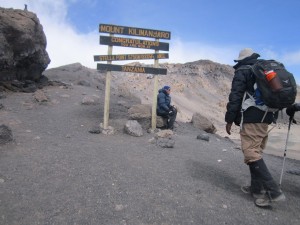
And we just kept walking, really. It was pretty rocky, anbd pretty slow, and there were some traffic jams when we met other groups. Well, when other groups attempted to pass us because, remember, slow. As you approach the (first) summit, it's kinda loose gravel, and we were going really slow. Like, maybe one step every two seconds. when we get about a hundred yards away from the first summit, we can see the brown and yellow "You've made it" sign, which pumped me up a little bit. Anyhow, we got to the first summit and got stoked and took photos and drank tea, but soon enough it was time to make the last push to the highest highest point.
[caption id="attachment_9685" align="aligncenter" width="300"]
 Stella Point![/caption]
It seemed like the next point was kinda close, but when we started walking it just seemed to get further. That happens a lot, actually. We're still going really slow, but that doesn't seem like such a problem anymore, since we're above 19k feet, so as long as you're going forward you're happy. (By this point, two dudes on our trip had decided to not continue on and two were suffering from pretty intense altitude sickness.)
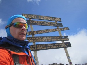
Maybe 45 minutes after the first peak, we get to Uhuru Peak. It's 12:30, which means it took us 8 hours and change to make it to the top. We're slow, but we're stoked. And we take a tooon of photos. And we wait for our group to all show up so we can do a photo together, which takes awhile, cause the last push had spread us out pretty thin. I think you're only supposed to spend 15 minutes at the top, but we were definitely there for closer to 45. Conveniently, I super duper have to go to the bathroom while we're up there, so maybe I didn't enjoy it as much as possible.
[caption id="attachment_9696" align="aligncenter" width="300"]
 We did it, you guys![/caption]
Dad and I took our an old cub scouts flag to pose with, as well as an A&M Flag, us being such faithful Aggies. Oh, can I embed Instagram videos? I must be able to. In fact, I was just looking at an embeddged Instagram video on deadspin. okay, let's see here...
Cool, I hope that worked. ALRIGHT. So this seems like a logical stopping point, but it's not. Cause we still have to go down the mountain. So we eventually wander back to the first peak, then we go down down down to our base camp. Here we ended up going in two different groups. Our group SCREAMED down the mountain, doing in maybe two hours what had taken us 7 in the morning. OBviously, going down is easy, but we were basically skiing down the mountain on our feet, shuffling through the loose, gravelly rocks that we'd been sludging through all morning. It was actually kinda fun, plus every step is an increase in oxygen, which is really great. [caption id="attachment_9707" align="aligncenter" width="300"]
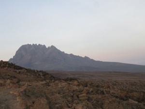 More mountain[/caption]
The third peak of Kilimanjaro, Mawenze, is visible to our left the whole way down. It gets a lot of photos taken of it. Eventually we make it down to our base camp, where we're greeted enthusiastically by all the porters who'd been waiting for us. I think they're all pretty happy that we made it, but I think they're equally happy that they had the morning/afternoon off to hang out at camp and not have to carry our stuff around. Anyhow, we get lunch, pack up our tents, and wait for the rest of our posse to return from the mountain. Over the next couple hours they start to show up, but they are beat! One dude collapses in the mess tent, another is so exhausted he's basically in a walking coma. And we still have a four hour hike to where we're sleeping that night! Not an easy day.
Anyhow, eventually we leave that camp and start hiking to the next camp/our last night. It's really long! I know I just said it a couple sentences ago, but we've hiked for like 12 hours so far and there's still 4 more. But what are you gonna do? Ain't gonna do nothing but keep walking. Which we do, until, jeez, like nine o'clock or something. But then we get to a nice camp, with dinner waiting for us and our tents set up. Food, brushing teeth, and our last night of camping on Kilimanjaro.
[gallery ids="9666,9667,9668,9669,9670,9671,9672,9673,9674,9675,9676,9677,9678,9679,9680,9681,9682,9683,9684,9685,9686,9687,9688,9689,9690,9691,9692,9693,9694,9695,9696,9697,9698,9699,9700,9701,9702,9703,9704,9705,9706,9707,9708,9709,9710,9711,9712,9713,9834,9835,9836,9837,9838,9839"] " data-title="Topofmanjaro 2015, Day 8: Summit Like it Hot" data-big="" />
 Alright! So we're finally back! Well, the night before we got back! But we woke up in a nice hotel, and I woke up extra early so I could have my own personal SURF-ARI, aka check my email. Then I went downstairs, where they served a nice breakfast, which we were really excited about, until we were told we had to RUSH AND GO OUTSIDE AND CATCH THE BUS ITS GONNA LEAVE AND GO ON THE SAFARI WITHOUT YOU!!! Then it would be a SO-CLOSE-BUT-SO-FAR-I because we missed the bus.
So we rushed! And we went outside!
And like 25 minutes later we left. Because SO-FAR-WE have done nothing on time, and you'd think after a week we'd know that. BUT NBD., we hung out and eventually piled into some Land Cruisers, aka SAFerrARIs.
Our driver chatted with us about the school system (private is better, but more $$$ go fig), the different tribes in the area (Warusha, Masai, Chagga, Meru) and how since he wasn't from around there (but from near Lake Victoria), he wasn't any of those, which meant his kids didn't speak his mother tongue but were apparently Swahili-monolingual (at that point; they'd learn English later). This driver wasn't intense about passing people, which was great cause I didn't have to constantly be wondering how SAFE-ARE-WE?
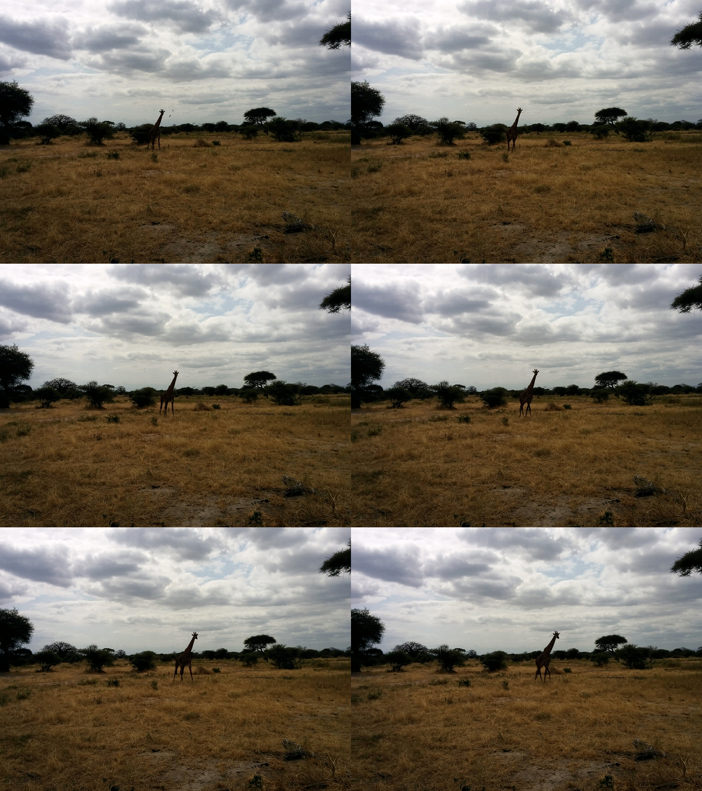
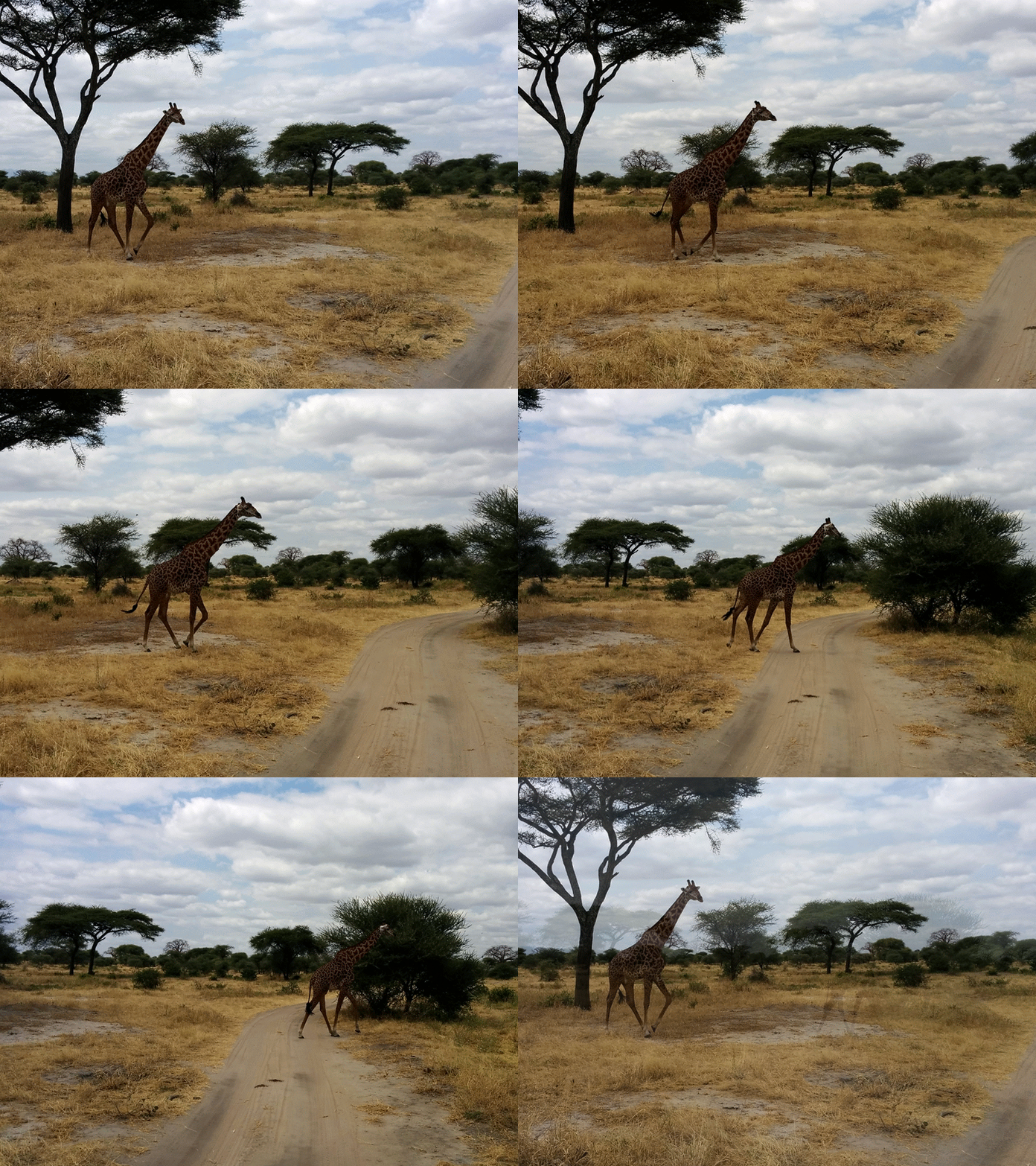
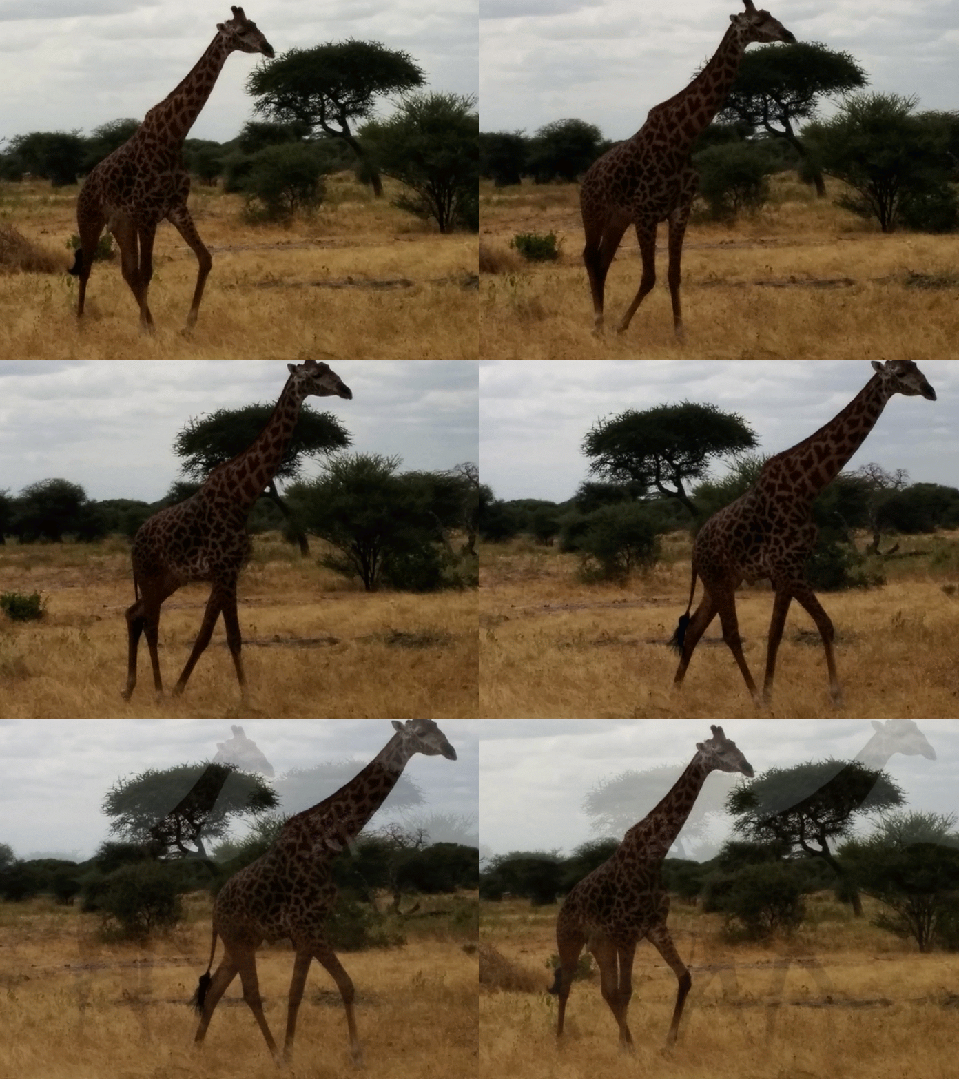
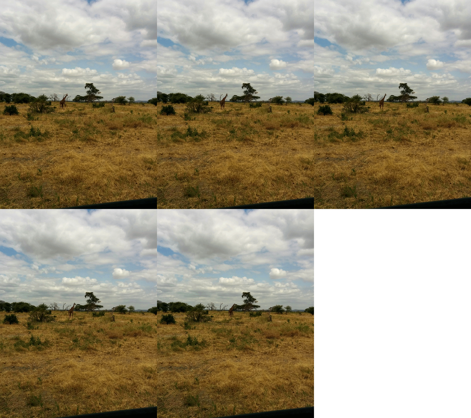
Anyhoo, this is the day we went to Tarangire National Park to see animals, so I am going to stop talking about Not-Animals and get to the InFact-Animals. Um. When we first got there, I saw an impala way off in the distance and kinda freaked out and took a ton of terrible photos. And then in five minutes I had seen like a million from much closer. And that scenario pretty much happened with every animal. Anyhow, here's a list of things we saw and I remember and may or may not have photos of:
- Zebra
- Water buck
- Impala
- Wildebeast
- Elephant
- Giraffe
- Dikdik
- Mongoose
- Lion
- Warthog
- Baboon
- Tufted Hawk (or something like that)
- Basket weaver
- Hornbill (maybe a Von Der Ducken or something like that, idk)
- Human (hahahah people are animals too hahahah)
- Some other smaller brown birds that werent that interesting sorry
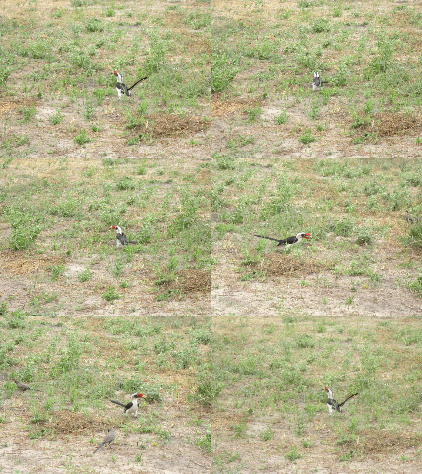 Hornbill.[/caption]
Um. What else? The guide was constantly on his radio with other guides. I thought maybe they were just chatting, but they were relaly sharing information about cool animals, which lead to us (sorta) seeing a lion. It was way donw in a valley and we could only just barely see it, but there were like 20 trucks all on this one little spot with all the safarers straining to see it. But it was cool; we saw a lion.
And a dead snake.
Um, yeah. Then we drove back, basically. We're leaving tomorrow.
[gallery ids="9751,9752,9753,9754,9755,9756,9757,9758,9759,9760,9761,9762,9763,9764,9765,9766,9767,9768,9769,9770,9771,9772,9773,9774,9775,9776,9777,9778,9779,9780,9781,9782,9783,9791,9790,9789,9788,9848,9849,9850,9851,9852,9853,9854,9855,9856,9857,9858"] " data-title="Kilanimaljaro 2015, Day 10: So Far We" data-big="" />
Hornbill.[/caption]
Um. What else? The guide was constantly on his radio with other guides. I thought maybe they were just chatting, but they were relaly sharing information about cool animals, which lead to us (sorta) seeing a lion. It was way donw in a valley and we could only just barely see it, but there were like 20 trucks all on this one little spot with all the safarers straining to see it. But it was cool; we saw a lion.
And a dead snake.
Um, yeah. Then we drove back, basically. We're leaving tomorrow.
[gallery ids="9751,9752,9753,9754,9755,9756,9757,9758,9759,9760,9761,9762,9763,9764,9765,9766,9767,9768,9769,9770,9771,9772,9773,9774,9775,9776,9777,9778,9779,9780,9781,9782,9783,9791,9790,9789,9788,9848,9849,9850,9851,9852,9853,9854,9855,9856,9857,9858"] " data-title="Kilanimaljaro 2015, Day 10: So Far We" data-big="" />Day 4! Really more like a Day 2, honestly, but I’m sticking to the numbering system we already set up.
Today was a little bit… real? We started off around 9 am with a tour of the Langa towship with Chippa of Siviwe Tours. We’d been told (and we now agree) that a township tour is a must-do/must-see. Beforehand, it felt like it might be a little exploitative/voyeury, but it didn’t feel that way doing it and was important to have that perspective as we experienced the rest of the country.
Our guide was born and raised in Langa and still lived there, and he was fantastic. He was pretty thorough in discussing the history and development of the township, and by the end was comfortable giving his less-varnished (though maybe not unvarnished) opinion of the current government and the leading figures in the history of the country. I don’t have much to offer about the problems and solutions the people face, by which I mean anything. It was jarring going from our straight-from-IKEA downtown apartment to the sheetmetal-and-cardboard of the township, and we kept it in mind throughout the trip. We didn’t take many photos.
Afterwards, we went to the waterfront, which was like pretty much every waterfront area anywhere- beautiful, clean, gelato options, t-shirts. Then we ferried over to Robben Island, the site of the prison where Mandela and tons of other political/other prisoners were held. The tour was given by an ex-inmate. Our group was’t terribly chatty, unfortunately, so most of the opportunities to ask questions were met with silence. There were also a handful of Afrikaners who didn’t speak English, which we just didn’t think existed.
Dinner that night was at Kloof Street House- fantastic food in an amazing, beautiful old house. I took a pretty epic photo of our wine, but that was pretty much it.
Day 3: Capetown and Table Mountain
Saturday , 14, January 2017 South Africa 2017, travel Leave a commentWe had prepared a pretty extensive itinerary for the trip- literally every meal, every grocery store trip, every little thing. The first day was our first chance to decide that maybe we over-planned and maybe we could just go with the flow.
But we didn’t! We totally stuck to the plan, eating at the super delicious Lola’s on Long Street. Really great way to start. Unlike previous trips, we were starting off with a strong food experience! After brekkie, we wandered down to some markets and looked through some stores before heading to the Old Biscuit Mill, which is *not* a place where they make old biscuits, whatever that would mean, but is an area that presumably used to be a regular biscuit mill but was now a sort of handmade megamall. Lots of cool everythings! Handmade selvedge denim pants, screen printing, cool weird lamps! Like Renegade Craft Fair or Crafty Bastards meets Union Market.
From here, we got an Uber (which was great and super convenient throughout the country, fwiw) to the Kirstenbosch Botanical garden, which was where the trailhead for the itinerary-defined hike to the top of Table Mountain was. The garden was beautiful, but we were in a hurry to start the pretty-log hike up and across the mountain, so we didn’t linger too long.

Beautiful place for a cricket match!
The trail was steep, but super well marked. Our jetlag wasn’t exactly our best friend at the time, but we were tough and fast and made it to the top, with some fun vistas along the way. The top of the mountain was as flat as a name like Table Mountain suggests (it’s not somehow named after the parliamentary procedure to end discussion of a particular motion), but the walk across was cool. Lotta fynbos, which is a thing you can look up. There’s a big pile o’ rocks up there called Maclears Beacon, which you can see below, probably:
After the hike, we took a cable car down the mountain, called another car and went back to apartment to freshen up before drinks and dinner. We went to a gin bar near our apartment, where I had a fantastic gin and tonic and the worst, grossest, saddest attempt at a Martinez cocktail ever. Yikes. Dinner at Savoy Cabbage was another great meal, though not as good as what would come! Unfortunately, we had to stop at a pharmacy to pick up some cold medicine as we’d contracted a little bug that would follow us around for the whole first half of the trip.
Day 2: More Travelling, but Capetown!
Friday , 13, January 2017 South Africa 2017, travel Leave a commentSo a case could be made for not actually needing to have included posts for the day we left and the day we spent flying through the air, across an ocean and past the equator. But we’re maximalists.
The flights were long and boring, but we made it. We wore pajamas for the flight to Amsterdam, which was fine until there wasn’t enough time to change before landing and we had to walk through the airport looking like… well, Americans, I suppose. We made it to Cape Town, got into a cab without much trouble, and made it to our Airbnb.
Our place was right downtown. We got a little nervous when the cab driver warned us about what a bad area it was and how most tourists don’t stay there for a reason. Whooops! But the place was cool and it used old style keys, which felt quaint and fancy at the same time. Anyhoo, fun stuff starts tomorrow!
Alright! So we’re finally back! Well, the night before we got back! But we woke up in a nice hotel, and I woke up extra early so I could have my own personal SURF-ARI, aka check my email. Then I went downstairs, where they served a nice breakfast, which we were really excited about, until we were told we had to RUSH AND GO OUTSIDE AND CATCH THE BUS ITS GONNA LEAVE AND GO ON THE SAFARI WITHOUT YOU!!! Then it would be a SO-CLOSE-BUT-SO-FAR-I because we missed the bus.
So we rushed! And we went outside!
And like 25 minutes later we left. Because SO-FAR-WE have done nothing on time, and you’d think after a week we’d know that. BUT NBD., we hung out and eventually piled into some Land Cruisers, aka SAFerrARIs.
Our driver chatted with us about the school system (private is better, but more $$$ go fig), the different tribes in the area (Warusha, Masai, Chagga, Meru) and how since he wasn’t from around there (but from near Lake Victoria), he wasn’t any of those, which meant his kids didn’t speak his mother tongue but were apparently Swahili-monolingual (at that point; they’d learn English later). This driver wasn’t intense about passing people, which was great cause I didn’t have to constantly be wondering how SAFE-ARE-WE?
Anyhoo, this is the day we went to Tarangire National Park to see animals, so I am going to stop talking about Not-Animals and get to the InFact-Animals. Um. When we first got there, I saw an impala way off in the distance and kinda freaked out and took a ton of terrible photos. And then in five minutes I had seen like a million from much closer. And that scenario pretty much happened with every animal. Anyhow, here’s a list of things we saw and I remember and may or may not have photos of:
- Zebra
- Water buck
- Impala
- Wildebeast
- Elephant
- Giraffe
- Dikdik
- Mongoose
- Lion
- Warthog
- Baboon
- Tufted Hawk (or something like that)
- Basket weaver
- Hornbill (maybe a Von Der Ducken or something like that, idk)
- Human (hahahah people are animals too hahahah)
- Some other smaller brown birds that werent that interesting sorry
Um. What else? The guide was constantly on his radio with other guides. I thought maybe they were just chatting, but they were relaly sharing information about cool animals, which lead to us (sorta) seeing a lion. It was way donw in a valley and we could only just barely see it, but there were like 20 trucks all on this one little spot with all the safarers straining to see it. But it was cool; we saw a lion.
And a dead snake.
Um, yeah. Then we drove back, basically. We’re leaving tomorrow.
Kilimandonezo 2015, Day 9: Mweka Like a Tree
Wednesday , 22, July 2015 Kilimanjaro 2015 Leave a commentFrom the itinerary:
A morning walking to Mweka gate reflecting of the past weeks experience with our Climb Kili vehicle waiting to transfer you to your hotel for a very welcomed shower at the hotel. Overnight at SG Resort.
Last day! So I don’t know if I mentioned this, but the night before we were supposed to have walked to some camp, but instead we stayed at some other camp because it was closer and, if you recall, we slow. Anyhow, we wake up at Millennium camp, which should have a reason for being named that but apparently it doesnt, and we walk to Mweka Gate. The itinerary suggested it would be an easy walk, which it was, but it also suggested it would be short, which it wasn’t. I think we left at 8 maybe, and we didn’t arrive until.. well I have no idea, but much later.
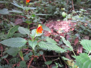
Cause we slow. But it didn’t bother me, the going slow, because it was the last day and the sooner we got to Mweka Gate the sooner the trip would be over. So we took our time, and I took my time taking my time. I photographed every mushroom I saw, tons of Kilimanjaro Impatiens, lots of rocks, etc.
The night before, as we came down the mountain, we had just left the rocky top of the mountain ecosystem and had entered the short little tree ecosystem. As we went further down the mountain, the trees got taller and the plant life thicker, and, in the highlight of the day, we started seeing monkeys again! Of course, my camera only barely registered them, but monkeys! Black and white ones. We actually didn’t see them until the very, very end, I think.
When we got to the gate, all our porters were there waiting for us, singing a welcome song. and dancing. It was fun. We signed the little book saying we completed the trail, had folks clean our boots for us, which was kinda weird but pretty nice, and ate lunch.
After lunch there was this (I thought super weird) ceremony thing where the lead guide announced to everyone how much of the tip pool each porter was going to get. (There was a tip pool.) It was interesting though for a couple reasons. One, I naively thought that the porters were all basically the same rank, so to speak, but that was not true. The bottom run and the lowest-tipped were the dudes that carried the portable toilet, which both makes sense and doesn’t make any sense at all. They were followed by the water carriers (also kinda backwards, considering how important water is), then the kinda general equipment porters, then the porters who carried our personal stuff, then the waiters/cooks assistants/cook, and finally the guides, with the lead guide getting the biggest chunk.
The other thing that was kinda funny about it was that the lead guide, who was making all the announcements, would say what each person was getting in English, but then he’s repeat it in (presumably) Swahili, which would elicit cheers from whoever just found out about his bonus. The reason I thought it was funny is that I had kinda assumed that everyone spoke English pretty well and the reason they didn’t talk to us much was because, you know, we’re just boring tourists and why bother talking to us? I also noticed that the further up the hierarchy the announcements went, the less likely it was he would repeat anything in Swahili, which made me think that English language skills were pretty directly related to how high up in the organization you could go. Of course, I could totally be reading the entire situation wrong, which would be my style and not at all surprising.
Anyhow, after that we all pile pack into the truck to head to Arusha. We have car trouble along the way, so we have to stop at a mechanic, but after 20 minutes and a couple bottles of something or other poured somewhere or wherever, we’re back on the road. We get to the SG hotel (which bills itself as a “neo-Africanized resort”?) and it is awesome. The first place we stayed at, like I mentioned, was expensive, had poor service, scary water, etc. I mean, it was fine, but when we got to the SG I was stoked. Okay i had just spend a week on a mountain, so of course it would at least feel better, but this place had pizza and a bar and weird neon lights in the rooms, and showers with reliable, non-scary hot water. So. Showers, dinner of pizza and beer, and bed! In a bed! Where I wasn’t even a little bit cold! And I’m going on a safari tomorrow!
Topofmanjaro 2015, Day 8: Summit Like it Hot
Tuesday , 21, July 2015 Kilimanjaro 2015 Leave a comment(Since I first began publishing these, Google has disabled embedding photospheres, because no good reason. So this will probably look dumb. sorry. You can also click here.)
From the itinerary
Day 6: BARAFU to SUMMIT to MWEKA CAMP
19,340’~5,895m ? 13 mi~21 km (5 km ascent/ 12 km descent) ? 7-8 hrs ascent~4-6 hrs descent
Tonight is the night! A midnight start to conquer the highest point in Africa. This section of the route is considered one of the steepest on the non-technical paths of Kilimanjaro. It is a 6-7 hour hike to Stella Point in order to see the sunrise. We continue our way to the summit between the Rebmann and Ratzel glaciers. We head in a northwesterly direction and ascend through heavy scree towards Stella Point on the crater rim. This can be the most mentally and physically challenging portion of the trek. From Stella Point you can see the summit; just 1 hour to Uhuru Peak and the rooftop of Africa! We then descend down to Mweka Camp for dinner and celebration.
Like I said yesterday, we had a change of plans. Rather than leaving super early and getting to the summit at sunrise, we just left a little early. So. Around 3:30 we were woken up with the customary coffee/tea, then we pretty much immediately left. I went to bed fully clothed (I think everyone did), so it was a pretty quick up-and-at-em.
So in the dark we start walking. And in the cold we start walking. It was really fun- walking in the dark. I tried to take as much time as possible to just look up- the stars were amazing and so much of the previous nights I was too cold to just sit outside at night for too long. Alas, we were walking in the dark, so I had to spend a fair amount of time watching the ground.
So. Walking in the dark. There’s not a lot to say about it. After a couple hours I was getting reeeeal cold. Well, not I was actually fine, broadly speaking, but my toes were getting cold cold cold! So I popped out a couple of those chemical handwarmers and jammed them into my boots. They take awhile to get started, but after an hour or so, feeling was back in Toesville. So that was pretty cool!
Eventually the sun rose.
And we just kept walking, really. It was pretty rocky, anbd pretty slow, and there were some traffic jams when we met other groups. Well, when other groups attempted to pass us because, remember, slow. As you approach the (first) summit, it’s kinda loose gravel, and we were going really slow. Like, maybe one step every two seconds. when we get about a hundred yards away from the first summit, we can see the brown and yellow “You’ve made it” sign, which pumped me up a little bit. Anyhow, we got to the first summit and got stoked and took photos and drank tea, but soon enough it was time to make the last push to the highest highest point.
It seemed like the next point was kinda close, but when we started walking it just seemed to get further. That happens a lot, actually. We’re still going really slow, but that doesn’t seem like such a problem anymore, since we’re above 19k feet, so as long as you’re going forward you’re happy. (By this point, two dudes on our trip had decided to not continue on and two were suffering from pretty intense altitude sickness.)
Maybe 45 minutes after the first peak, we get to Uhuru Peak. It’s 12:30, which means it took us 8 hours and change to make it to the top. We’re slow, but we’re stoked. And we take a tooon of photos. And we wait for our group to all show up so we can do a photo together, which takes awhile, cause the last push had spread us out pretty thin. I think you’re only supposed to spend 15 minutes at the top, but we were definitely there for closer to 45. Conveniently, I super duper have to go to the bathroom while we’re up there, so maybe I didn’t enjoy it as much as possible.
Dad and I took our an old cub scouts flag to pose with, as well as an A&M Flag, us being such faithful Aggies. Oh, can I embed Instagram videos? I must be able to. In fact, I was just looking at an embeddged Instagram video on deadspin. okay, let’s see here…
Cool, I hope that worked.
ALRIGHT. So this seems like a logical stopping point, but it’s not. Cause we still have to go down the mountain. So we eventually wander back to the first peak, then we go down down down to our base camp. Here we ended up going in two different groups. Our group SCREAMED down the mountain, doing in maybe two hours what had taken us 7 in the morning. OBviously, going down is easy, but we were basically skiing down the mountain on our feet, shuffling through the loose, gravelly rocks that we’d been sludging through all morning. It was actually kinda fun, plus every step is an increase in oxygen, which is really great.
The third peak of Kilimanjaro, Mawenze, is visible to our left the whole way down. It gets a lot of photos taken of it. Eventually we make it down to our base camp, where we’re greeted enthusiastically by all the porters who’d been waiting for us. I think they’re all pretty happy that we made it, but I think they’re equally happy that they had the morning/afternoon off to hang out at camp and not have to carry our stuff around. Anyhow, we get lunch, pack up our tents, and wait for the rest of our posse to return from the mountain. Over the next couple hours they start to show up, but they are beat! One dude collapses in the mess tent, another is so exhausted he’s basically in a walking coma. And we still have a four hour hike to where we’re sleeping that night! Not an easy day.
Anyhow, eventually we leave that camp and start hiking to the next camp/our last night. It’s really long! I know I just said it a couple sentences ago, but we’ve hiked for like 12 hours so far and there’s still 4 more. But what are you gonna do? Ain’t gonna do nothing but keep walking. Which we do, until, jeez, like nine o’clock or something. But then we get to a nice camp, with dinner waiting for us and our tents set up. Food, brushing teeth, and our last night of camping on Kilimanjaro.


